The Rural Land Register is a key dataset maintained by RPA which underpins the delivery of the land-based schemes, such as Basic Payment Scheme, Countryside Stewardship and Sustainable Farming Incentive, to ensure accurate payments are made to farmers and land managers.
RPA systematically reviews and updates data held on the Rural Land Register as the areas claimed by customers need to correspond with eligible areas within those land parcels for a claim to be paid.
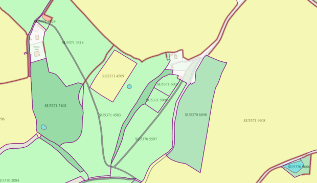
Overall, RPA maps and maintains 2.7 million land parcels, and within those are 4.6 million land covers that tell us which features are present in each land parcel, such as arable land, woodland, ponds and farmyards. We also maintain eight million hedges as linear features within, or on, the boundary of land parcels.
Proactive Land Change Detection
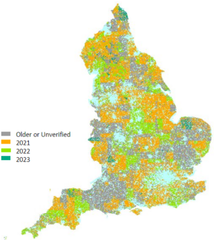
Proactive Land Change Detection (PLCD), is an exercise run by RPA to review any land parcels which haven’t been updated or assessed within the past three years. We review around 900,000 parcels each year, one third of the total number. The PLCD activity improves the accuracy of the Rural Land Register, and therefore payments to customers.
RPA monitors the Rural Land Register each month and applies spatial analysis to see which potential land parcels will receive updated intelligence during the year. Land parcels can also be updated by other means, such as a customer edit request, a farm visit by RPA field officers, or remote inspections using satellite imagery. We also consider which agri-environmental subsidy schemes the parcels are being claimed under to make sure our checks are done at the right time so we don’t disrupt payments.
Once the land parcels have been identified, they’re reviewed manually to identify any changes to the boundaries or land covers. RPA receives aerial photography covering one third of the country each year, and also makes use of other intelligence such as Ordnance Survey MasterMap and satellite imagery.
Key facts
- The Rural Land Register covers 75% of England
- This includes 2.7 million land parcels (fields) and, within those, 4.5 million land cover polygons i.e. arable, permanent grassland
- Proactive Land Change Detection (PLCD) is a review of around 900,000 land parcels every year to ensure the accuracy of the RLR
- Last year, 11% of those checks resulted in an edit to the land parcel or land cover.
4 comments
Comment by D Willoughby posted on
From my experience this actually results in incorrect changes being made and then it is up to us the farmer to spend more time and bureaucracy trying to rectify it.
Comment by Alex Bywaters posted on
There are failings of the hedge mapping.
My land appears to have hedges but is, in fact, dry stone walls.
Why is there not some consultation on changes to make sure you have it right?
Comment by vickiallonby posted on
Thank you for your query. I have passed this to the relevant team and will respond as soon as possible.
Comment by vickiallonby posted on
Thank you for your query. Please can you email the Geospatial team - GeospatialTeam@rpa.gov.uk quoting your SBI number and land parcel details and the team will assist with checking your hedges are showing correctly. We have a large volume of proactive changes each year, circa 100,000, which means it is not possible to consult with customers each time we identify a potential change. I hope this helps.